Below the Roaring 40s, there is no Law and below the Furious Fifties, there is no God!
- An old sailors' saying
Exploring the Southern Ocean
Antarctica, the coldest, windiest, and driest continent at the bottom of the world is surrounded by icy water on all sides. The waters of the Atlantic, Pacific and Indian Oceans swirl around this land mass in a wind driven fury.
These ocean waters are isolated from a body of water known as the Southern Ocean by an oceanographic phenomenon called the Antarctic Convergence. The Southern Ocean extends from the coast of Antarctica north to 60 degrees south latitude which coincides with the Antarctic Treaty Limit.
The Southern Ocean is an important element of the biology of the continent and of the climate. Indeed, this body of water affects the meteorological patterns of the entire globe.
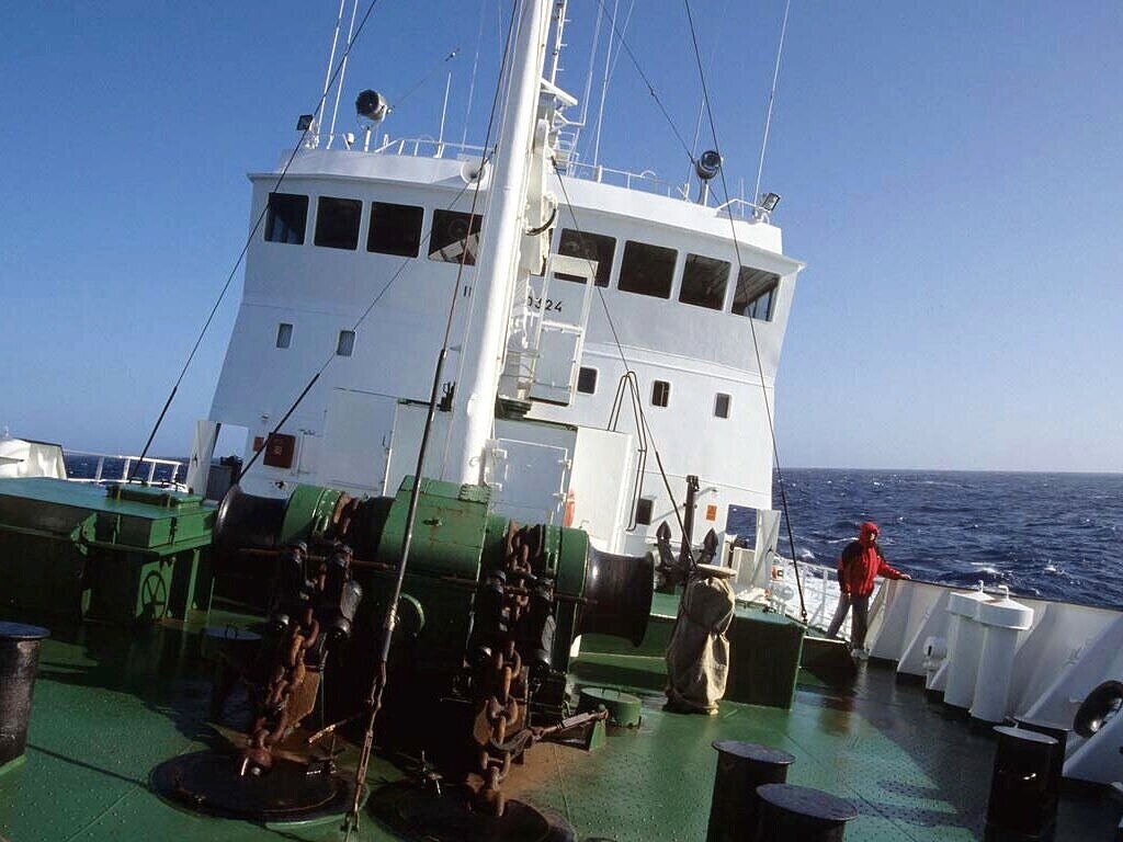
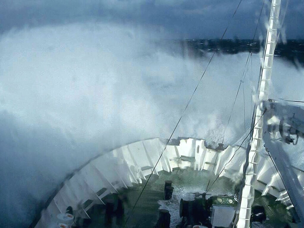
Most visitors to Antarctica journey across a narrow stretch of water separating South America and the Antarctic Peninsula known as the Drake Passage. Others cross from points in Australia and South Africa. Those who journey south will pass through the “roaring forties” and then the “furious fifties”, colorful monikers for longitudinal lines indicating the southern progress towards the ice kingdom of Antarctica. After voyaging through the “screaming sixties”, the continent becomes visible. These ominous terms come from the sailors who have made these difficult journeys in the past. The waters of this ocean are turbulent. Persistent westerly winds generate strong swells and, sometimes, mountainous seas. Lucky passengers experience relatively calm seas, when the passage is known as the “Drake Lake”. Others pay “The Drake Tax” and experience the “Drake Shake”.
View the Current Wave Height and Direction (South Atlantic Region)
The Southern Ocean is the fourth largest ocean (after the Pacific Ocean, Atlantic Ocean, and Indian Ocean, but larger than the Arctic Ocean), with an area roughly 13.7 million square miles. Technically, the Southern Ocean begins at the Antarctic Convergence and extends to the coasts of the continent.
The Antarctic Convergence is marked by a noticeable decline in water temperatures. The change is sudden and can amount to a 3-5 degree Fahrenheit drop. The waters below the convergence differ in temperature, density and salinity. The exact location of the convergence varies slightly throughout the year. When crossing the convergence there is little surface indication of the event…the waters aren’t rougher and there is no obvious change in appearance. Usually the engineers of the vessel will detect the temperature drop and announce the crossing based on that observation.
One important feature of the Southern Ocean is the Antarctic Circumpolar Current. This is the world’s biggest ocean current, flowing eastward at an astonishing rate of 153 million cubic meters per second. This is roughly a thousand times the flow of the Amazon.
Like all the Earth’s oceans, the Southern Ocean is made up of separate water masses or layers. These masses flow in different directions based on surface conditions (usually wind driven) and gravitational forces. In the Southern Ocean there are two distinct surface currents, pushed by strong prevailing winds in opposite directions. Beneath the surface run counter currents generated by the Earth’s rotation and gravitational forces. These sub-surface currents carry cold, Antarctic waters northward and bring warm subtropical waters southward to replace them.
Between latitudes 50 and 60s, successive cyclonic storms produce strong winds resulting in the West Wind Drift. This current moves eastward at around 2.2 miles per hour. The northern boundary of this current spreads northward with cold Antarctic water, mixing with relatively warm sub-tropical waters. This mixing zone is the Antarctic Convergence.
Closer to the continent, southerly winds blowing off Antarctica are diverted by the Earth’s rotation, producing easterly winds which drive the East Wind Drift. This current flows at 1/10 the speed of the West Wind Drift and moves westward.
Between the two surface currents, lies an area known as the Antarctic Divergence, a section of water rich in nutrients. Here large populations of krill and fish can be found, along with the creatures that feed on them (seals, sea birds and whales).
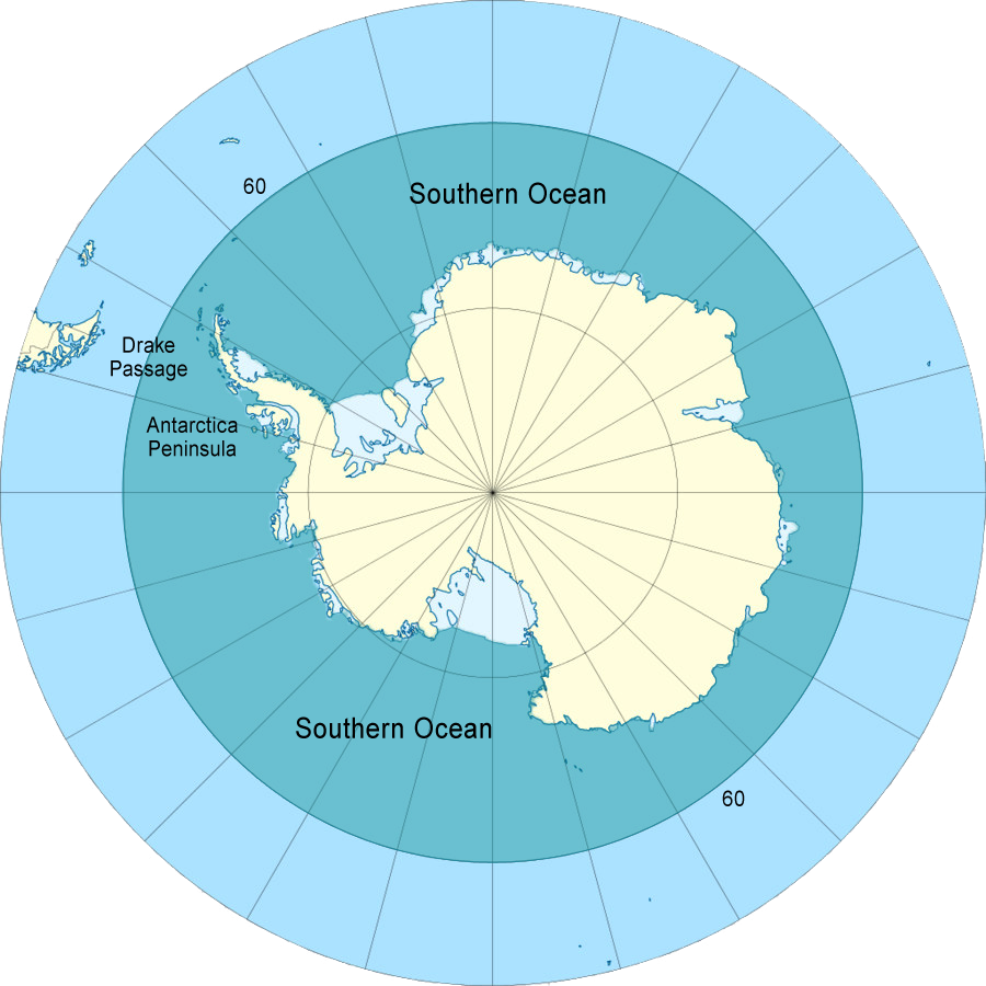
The Southern Ocean is shown in blue-green or teal color.
Figure 1
Southern Ocean Geography
Content Courtesy - CIA The World Factbook
Location: body of water between 60 degrees south latitude and Antarctica Geographic coordinates: 65 00 S, 0 00 E (nominally), but the Southern Ocean has the unique distinction of being a large circumpolar body of water totally encircling the continent of Antarctica; this ring of water lies between 60 degrees south latitude and the coast of Antarctica, and encompasses 360 degrees of longitude.
Area: total: 20.327 million sq km. This includes Amundsen Sea, Bellingshausen Sea, part of the Drake Passage, Ross Sea, a small part of the Scotia Sea, Weddell Sea, and other tributary water bodies.
Area - comparative: slightly more than twice the size of the US.
Coastline: 17,968 km
Climate: sea temperatures vary from about 10 degrees Celsius to -2 degrees Celsius; cyclonic storms travel eastward around the continent and frequently are intense because of the temperature contrast between ice and open ocean; the ocean area from about latitude 40 south to the Antarctic Circle has the strongest average winds found anywhere on Earth; in winter the ocean freezes outward to 65 degrees south latitude in the Pacific sector and 55 degrees south latitude in the Atlantic sector, lowering surface temperatures well below 0 degrees Celsius; at some coastal points intense persistent drainage winds from the interior keep the shoreline ice-free throughout the winter.
Terrain: the Southern Ocean is deep, 4,000 to 5,000 meters over most of its extent with only limited areas of shallow water; the Antarctic continental shelf is generally narrow and unusually deep - its edge lying at depths of 400 to 800 meters (the global mean is 133 meters); the Antarctic icepack grows from an average minimum of 2.6 million square kilometers in March to about 18.8 million square kilometers in September, better than a sixfold increase in area; the Antarctic Circumpolar Current (21,000 km in length) moves perpetually eastward; it is the world's largest ocean current, transporting 130 million cubic meters of water per second - 100 times the flow of all the world's rivers.
Elevation Extremes:
lowest point: -7,235 m at the southern end of the South Sandwich Trench.
Highest point: sea level 0 m.
Natural resources: probable large and possible giant oil and gas fields on the continental margin, manganese nodules, possible placer deposits, sand and gravel, fresh water as icebergs, squid, whales, and seals - none exploited; krill, fishes.
Natural hazards: huge icebergs with drafts up to several hundred meters; smaller bergs and iceberg fragments; sea ice (generally 0.5 to 1 meter thick) with sometimes dynamic short-term variations and with large annual and interannual variations; deep continental shelf floored by glacial deposits varying widely over short distances; high winds and large waves much of the year; ship icing, especially May-October; most of region is remote from sources of search and rescue.
Environment - current issues: increased solar ultraviolet radiation resulting from the Antarctic ozone hole in recent years, reducing marine primary productivity (phytoplankton) by as much as 15% and damaging the DNA of some fish; illegal, unreported, and unregulated fishing in recent years, especially the landing of an estimated five to six times more Patagonian toothfish than the regulated fishery, which is likely to affect the sustainability of the stock; large amount of incidental mortality of seabirds resulting from long-line fishing for toothfish
Note: the now-protected fur seal population is making a strong comeback after severe overexploitation in the 18th and 19th centuries.
Environment - international agreements: the Southern Ocean is subject to all international agreements regarding the world's oceans; in addition, it is subject to these agreements specific to the Antarctic region: International Whaling Commission (prohibits commercial whaling south of 40 degrees south [south of 60 degrees south between 50 degrees and 130 degrees west]); Convention on the Conservation of Antarctic Seals (limits sealing); Convention on the Conservation of Antarctic Marine Living Resources (regulates fishing)
Note: many nations (including the US) prohibit mineral resource exploration and exploitation south of the fluctuating Polar Front (Antarctic Convergence) which is in the middle of the Antarctic Circumpolar Current and serves as the dividing line between the very cold polar surface waters to the south and the warmer waters to the north.
Geography - note: the major chokepoint is the Drake Passage between South America and Antarctica; the Polar Front (Antarctic Convergence) is the best natural definition of the northern extent of the Southern Ocean; it is a distinct region at the middle of the Antarctic Circumpolar Current that separates the very cold polar surface waters to the south from the warmer waters to the north; the Front and the Current extend entirely around Antarctica, reaching south of 60 degrees south near New Zealand and near 48 degrees south in the far South Atlantic coinciding with the path of the maximum westerly winds.